
Water Closet for July 18, 2014
A stone, little seen by humans, marks where North Reading, North Andover, and Middleton meet. Six feet high, roughly triangular in cross section, it reminds us of an obelisk sculpted by Mother Nature and later found and used by man. On the east face is an M, on the southwest side an R, and on the third facing northwest an A. The three letters were carefully carved by a person not Mother Nature. [pullquote]”How lucky we are – this place and lots more can be found in our Ipswich River Watershed, many protected for us all.”[/pullquote]The monument was probably placed before the Norths were incorporated or maybe the stone carvers just left the unnecessary Ns off. By its looks the lichen pocked marker was put up before the Norths and after Middleton was split off from Salem in 1728. People like to think of such things as older. When experts carbon dated the original wood in several ancient Ipswich houses that proudly displayed signs like 1672 on their front they found the wood was not quite so old. Were the signs taken down and new ones put up?
The Middleton Friday morning Council on Aging/Conservation Commission (COA/CC) hikers had happened upon this fine old stone when they did their first “Sudden Pond Loop” a few years ago. The woodland there is rough and has no path. This past Fourth of July Friday, the day hurricane Arthur passed us by, hiker MARY said upon reading the stone’s letters, “They left out the Y.” Some us no longer quick heard the Y as only Why? We wondered again about the seemingly arbitrary nature of man’s placement of bounds.
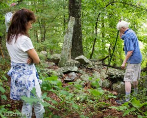
Three towns bound: “Red”, now white, Caulfield of Middleton is standing in North Reading. Bonnie (Peruffo) MacPhee from North Andover is standing in once Andover. See the A for Andover on old stone monument. The oak behind is in Middleton.
All three are in Harold Parker State Forest. – Judy Schneider photo
From what we’ve read the Indians thought the English penchant for lot lines, fences, walls, bounds, and markers strange. Today the ledge based ups and downs where we stood shaded by mature hardwoods is in the southeastern-most part Harold Parker State Forest, little visited now the rough terrain is no longer open pasture. The 60 or so year old oaks are single indicating each arose from an acorn not the sprouts of a cut stump. Multi-trunks tell of logging of an earlier generation of trees. Single trunks tell us it was open pasture mid last century. Old photos showing Civilian Conservation Corps (CCC) lads working on the park in brush and sapling abandoned pasture land are more easily appreciated evidence. Landscape detectives prefer more woody clues.
Gathered around the monument our group looked southeast at vast Emerson Bog below, a lushly vegetated swamp accessible on ice in winter. It is a large reservoir of the Danvers Water Department between Forest Street and North Main Street in Middleton. Most is shallow thus allowing a jungle of emergent water plants. Two open circular ponds in the bog called Knights Pond and Andover Meadow Pond are deeper. We think them kettle ponds from melting blocks of ice left by the glacier. One old Closeteer on skates used to visit ice fishermen there tending their flags. They gave him yellow perch they didn’t want and had cast aside around their holes. He and his good wife think them very tasty.
It is summer, let’s return to the COA/CC hikers who continued on east under high shade above the north edge of the bog. The woods are relatively open with little ground or bushes. The walkers without a path moved slowly; the topography like much in the area is ledgey and rough. Soon they were stopped by a brook coming down from Stearns Pond made by a Civilian Conservation Corps (CCC) dam a mile to the northwest in North Andover. The water was flowing slowly despite an inch of rain the night before. The beavers have at least three dams between Stearns Pond and Emerson Bog. The largest of the three on the brook was a planned stop before continuing on to our destination at Sudden Pond. Eighty or so years ago the CCC boys built a dam and suddenly there was Sudden Pond. Nearby, in the brook down from Stearns Pond, beavers have built a much longer dam that has resulted in a half-mile long impoundment of still water where a forest once stood.
On emerging from the brook’s valley of granite clothed by soil and mature trees we came upon the 15 year old beaver dam over 200-ft. long and 6-ft. high. The sticks, mud and constant water are a porous wall of growth medium covered with herbaceous and bushy plants. Because of this screening jungle it is hard to appreciate the scale of the dam from the downstream side. Above is a quiet lake where last millennium there was a red maple swamp. Below the dam overflow and leakage trickles down among blackened moss-covered rocks. This mighty structure, perhaps 400 cubic yards, has been built by beavers who add more each year. Now in the forest near where the three towns meet there is a shallow beaver lake open to the sun, a place where wildlife thrives. We visit now and then to watch. The best times are dawn and dusk alone. Friday our large group stopped and rested a bit on a gentle bank after bushwhacking a rough half-mile. Tree swallows swooped by catching bugs we couldn’t see. Despite all the water there were no mosquitoes. Birds, dragon flies and damsel flies were thanked for that.
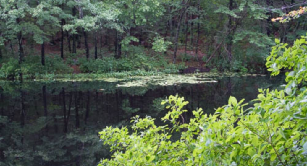
Rain drops, indirectly due to hurricane Arthur, joined us. We moved on westward toward Sudden Pond, the lovely manmade lake we like to circle on an undulating CCC path beneath oaks, pines and hemlocks. In places the young men from poor families made rough stairs of stone. The white water lilies in the pond beckoned. Increasingly raindrops threatened. Their concentric circles widening on the calm water rippled by round lily leaves. The pond was full of circles: floating round-green-flat leaves, others ephemeral. The hikers fearful of a soaking decided to leave the circumnavigation of Sudden Pond for another day. They picked up their pace back toward the shelter of cars.
En route back to the start the watery wonders of it all including cool drops on faces were silently hailed by some. Within a quarter mile of the three towns’ monument was life giving water in abundance in different forms. Rain called forth by Arthur out over the Atlantic fell from the sky. To the east was vast Emerson Bog with its ponds; to the north a yearly growing beaver impoundment, and to the west manmade Sudden Pond, each separated by mature woods thus unseen from one another. As we arrived at Salem Road the gentle rain, we needn’t have fussed about, let up. We drove on west to another much larger CCC made pond. Stearns Pond in July is a mile long paddy of white water lilies now ringed with the blue blossoms of pickerel weed. We picked some of both to bring home perhaps so memories of the hike among the ponds and swamp would linger. Or at least to show folks at home a bit of what we’d seen.
How lucky we are – this place and lots more can be found in our Ipswich River Watershed, many protected for us all.
_______________________________________________________________________
WATER RESOURCE AND CONSERVATION INFORMATION
FOR MIDDLETON, BOXFORD AND TOPSFIELD
| Precipitation Data* for Month of: | April | May | June | July | |
| 30 Year Normal (1981 – 2010) Inches | 4.53 | 4.06 | 3.95 | 3.89 | |
| 2013 – 14 Central Watershed Actual | 2.88 | 2.77 | 2.03 | 3.9 as of 7/15** | |
Ipswich R. Flow Rate(S. Middleton USGS Gage) in Cubic Feet/ Second (CFS):
For July 15, 2014 Normal . . . 9.2 CFS Current Rate . . . 20 CFS
**Updated July precipitation data is from MST gage..*Danvers Water Filtration Plant, Lake Street, Middleton is the source for actual precipitation data thru June. Normalsdata is from the National Climatic Data Center.
THE WATER CLOSET is provided by the Middleton Stream Team: www.middletonstreamteam.org or <MSTMiddletonMA@gmail.com> or (978) 777-4584

Roger, you’re doing an absolutely awesome job!