Water Closet for September 29, 2017
The Parker River flows between the Merrimack and Ipswich rivers as it meanders fifteen miles from Groveland to Plum Island Sound. [pullquote]”Humans have paddled these waters for 10,000 years. They’ll no doubt continue in the estuaries of an ever changing coast”[/pullquote]In mid-September several Middleton Stream Teamers and friends in two canoes and seven kayaks joined the flow at Middle Road in Newbury near The Governor’s Academy.1 The paddlers put in among the cattails and leisurely rode easterly on a high ebb tide flanked by an ever saltier marsh of largely short salt marsh grasses. The brackish water-loving narrow leaf cattails were soon left behind. Had the paddlers tasted the water en route they’d have found it only moderately salty. The seawater that had come in on the morning’s flood tide had mixed with the freshwater runoff and groundwater from the upriver watershed. The total area drained by the Parker River and its tributaries is 82 square miles. A morning fog had lifted; the world between the sky and water was lush green. Only a few distant Virginia creeper vines climbing trees on the marshes’ edges showed the bright red of fall. Cord grass on the river’s banks and salt hay grass on the flat high marsh2 showed no signs of the caramel color they’ll soon become. Here and there on the marsh small patches of glasswort had turned shiny green to pink-maroon. While stopping for a picnic lunch on a knoll of granite at the convergence of the Mill River up from Rowley, the paddlers found and tasted the reddening leaves of “pickleweed,” another name for glasswort. One paddler found that those that had turned red are saltier than those still green. In years gone by this little succulent was pickled for use as a winter condiment.
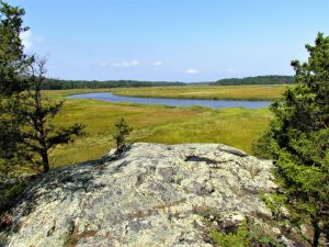
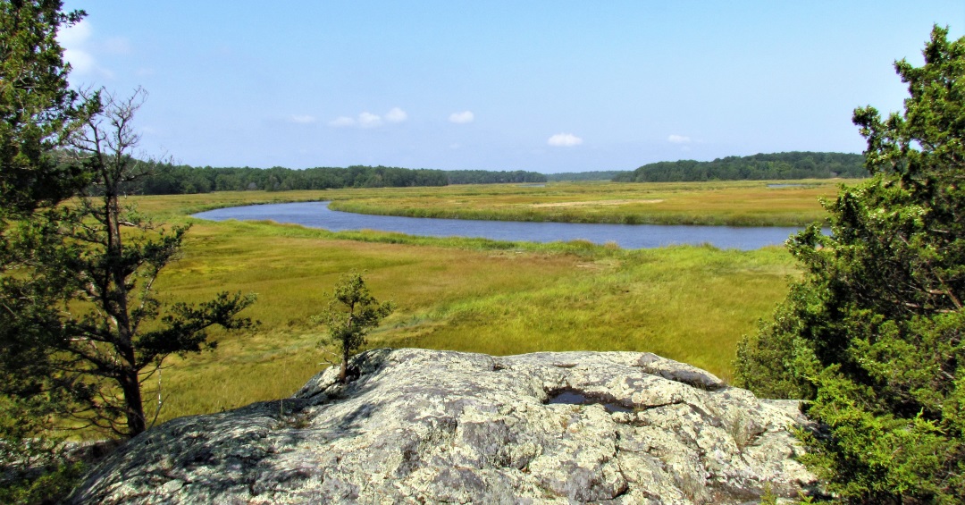
View of the Parker River and its salt marsh in Newbury as seen from a knoll with exposed granite ledge. The marsh is less than 3000 years old; the rock of the ledge is over 300 million. – Elaine Gauthier photo
The northeast corner of the picnic knoll has a high expanse of ledge facing northeast that provides a fine view of the river and salt marsh. As the paddlers parked their vessels in the cord grass, a Newbury man with two young daughters passed by slowly in a motor boat. Friendly, when questioned about the ledge where they had stopped, he volunteered. “I was engaged on that rock. I brought my bride-to-be out here with a ring and a bottle of champagne. She said yes. ” How could she have said otherwise in such a lovely place? The paddlers wondered how many others had been courted in this lovely estuary painted and photographed so many times. Martin Johnson Heade of the Hudson School of Illuminists introduced our salt marshes to the world in the 19th century after visits here and other marshes along the east coast. For years the Closeteer had passed along the legend that famous Heade painted with Frank Thurlo, a Newburyport artist and frame shop owner who did scores of marsh scenes. There is no evidence of this, but examination of the men’s paintings strongly indicate a connection. The younger Thurlo no doubt knew of Heade and may have been inspired by him.
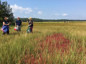
Glasswort, a small succulent marsh plant, turns red in September. Paddlers from the Parker River are tasting the soft stems of this plant once pickled for use as a winter condiment. – Elaine Gauthier photo
The snack laden paddlers climbed to a red cedar and oak-fringed clearing on the knoll’s top. As they ate and rested the old Closeteer’s mind drifted back to his days as a young boy in late July and early August on the salt marshes of Salisbury where his grandmother brought food and a refreshing molasses-water drink called switchel to her husband and helpers making hay. While they ate she fished for eels and flounders in nearby Pettengill’s Crick. On catching an eel she would scream. Much amused one of the hay makers would run to her and take the squirming eel off the hook. Here and all along the Parker’s tidal waters from colonial times into the early 20th century almost all the high marsh was mown for “salt meadow hay.” The miles of crick and river banks were also cut for cord grass that was used before the Revolution for thatch. Some high marsh hay is still cut for mulch. The seeds won’t sprout in upland soils. Winter ice cuts the tall cord grass which then drifts in on the high-runner-tides of nor’easters to pile up on the shoulders of causeways. Some is yearly gathered by the Closeteer as free mulch. Out beyond Route 1A, in from the barrier beaches on the low tide flats, the grass cutters might have brought home baskets of clams if they caught a low tide and could spare the time. As a boy the Closeteer dug sea worms on the same flats, which he and friends used as flounder bait.
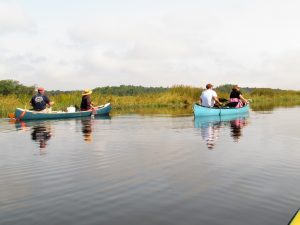
Canoes such as these are now out numbered by kayaks. These paddlers are riding the high ebb tide on the Parker River in Newbury. – Elaine Gauthier photo
After lunch the paddlers returned to their vessels. The water level had dropped two feet and the descent down the muddy bank to the floating canoes and kayaks was tricky. One spunky lady slid into the water up to her shoulders. Stream Teamer Glenn helped pull her out and into canoe. Asked by her canoe mate if she was all right and needed a dry shirt, she said, “Feels good in this heat.”
An easterly breeze riffled the water and replaced the hot humid air as the paddle down the beautiful, ever-widening Parker River resumed. Soon the fleet passed under the Boston and Maine Railroad Bridge at half tide when tidal flows are at maximum velocity. The Closeteer remembered his late mother telling how much she liked her daily commute by rail to school in Boston almost a century ago across the several salt marshes seen en route to North Station. In too short a time the paddlers passed under the new Route 1A Bridge to a landing where they took out and returned to being landlubbers. With the tide they could have easily paddled another four miles down to Plum Island Sound and on to the mouth of the Ipswich River and the sea, or north up the Plum Island River to the mighty Merrimack.3
As long as the gravities of the Moon, Earth and Sun interact the tides will keep on coming. Humans have paddled these waters for 10,000 years. They’ll no doubt continue in the estuaries of an ever changing coast.
- For PR reasons the governor’s surname Dummer was dropped this millennium from the name of centuries old Governor Dummer Academy. Many alumni disagreed with the change considering it incorrect and snooty.
- The flat surfaces of the salt marshes seen when passing through our estuaries are the elevation of mean high seawater. On spring tides, when the moon is full or new, the marsh grasses are often covered by higher water. On neap tides which correspond with the first and last quarter moons, the levels, at twice daily highs, are lower than average. On September 17, the day of the Stream Team paddle, the tide chart read: high 9.9 ft.; low, -0.3 ft. Three days later, the day of the new moon: high 10.7 ft.; low -0.7 ft. On full and new moons the spring tides are higher and lower than average. On the neaps the ranges between highs and lows are less. The haymakers used to cut on the neaps when the marsh was relatively dry.
- Comparing some of our rivers: Parker – 20 miles long, watershed 82 sq. mi.; Ipswich – 35 mi. long, watershed 155 sq. mi.; Merrimack – 117 mi. long, watershed 5,010 sq. mi.; Piscataqua (See last week’s WC.) 14 mi. long, 1,495 sq. mi.
__________________________________________________________
WATER RESOURCE AND CONSERVATION INFORMATION
FOR MIDDLETON, BOXFORD AND TOPSFIELD
| Precipitation Data* for Month of: | June | July | Aug | Sept | |
| 30 Year Normal (1981 – 2010) Inches | 3.95 | 3.89 | 3.37 | 3.77 | |
| 2017 Central Watershed Actual | 6.08 | 3.43 | 1.22 | 2.7 as of Sept 22 | |
Ipswich R. Flow Rate (S. Middleton USGS Gage) in Cubic Feet/ Second (CFS):
For Sept 22, 2017 Normal . . . 5.5 CFS Current Rate . . . 3.13 CFS
——————————————————————–
*Danvers Water Filtration Plant, Lake Street, Middleton is the source for actual precipitation data thru Aug.
** Middleton Stream Team is the source of actual precipitation data for Sept..
Normals data is from the National Climatic Data Center.
THE WATER CLOSET is provided by the Middleton Stream Team: www.middletonstreamteam.org or <MSTMiddletonMA@gmail.com>